 EMODnet Product Catalogue
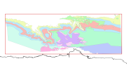
Protected sites
Type of resources
Available actions
Topics
Keywords
Contact for the resource
Provided by
Years
Formats
Representation types
Update frequencies
status
Scale 1:
Resolution
-
Port of Rotterdam is carrying out the Project Mainport Development Rotterdam, PMR, expanding the port with 1,000 hectares through suppletion of sand in the shallow coastal Voordelta area in the North Sea. As the Voordelta has the status of protected nature reserve (Natura2000 area), the loss of habitat, caused by the expansion of the port, must be compensated for. As part of the compensating measures, the Dutch national government established a series of protected areas in the Voordelta region and is following the effects of these measures. This dataset contains abundances of macrobenthis in the “Voordelta”. The set exists of a pre-protected status data (2003 – 2007) and a post-protected status (currently still under embargo).
-
The dataset on the shellfish protected areas under the Water Framework Directive (WFD) was created in 2023 by AND-International for the European Marine Observation and Data Network (EMODnet). The Directive (Article 6, paragraphs 1 and 2) requires Member States to designate areas which require specific protection of their surface water and groundwater, or for the conservation of habitats and species directly depending on water. According to Annex IV (ii) of the WFD, these areas should include areas designated for the protection of economically significant aquatic species (shellfish in this case). This dataset compiles the designated areas as provided by national sources (The Department of Housing, Planning, Community and Local Government of Ireland and The Ministry for Ecological Transition and Demography in Spain) and it is available for viewing and download on EMODnet web portal (Human Activities, https://emodnet.ec.europa.eu/en/human-activities). Each polygon has the following attributes: area ID (in EMODnet), country, area name, designation date, ID from the source.
-
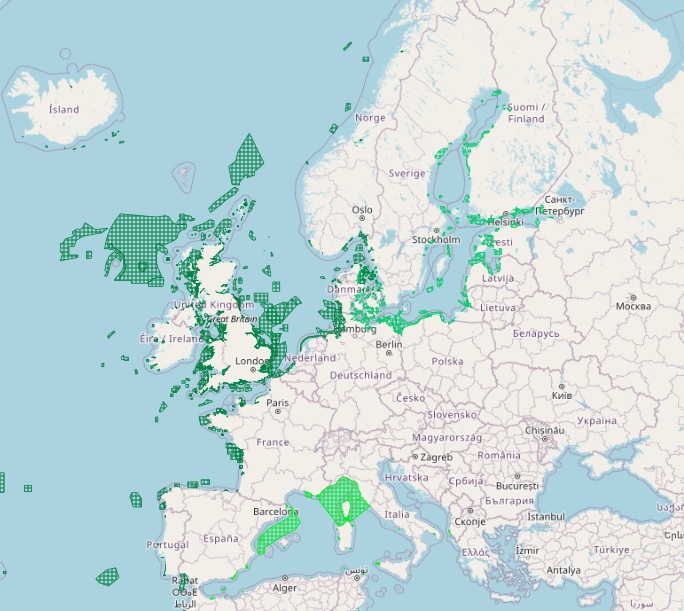
The dataset on Marine Protected Areas (MPAs) established under the framework of the Regional Sea Conventions (RSCs) was created in 2023 by Cogea for the European Marine Observation and Data Network (EMODnet). It is based on spatial data provided by HELCOM (HELCOM_MPAs_2019_2), by SPA/RAC and MedPAN through the MAPAMED database (MAPAMED_SPAMI_2019_edition_version_2), and by OSPAR (OSPAR_MPAs_202107_001). It is available for viewing and download on EMODnet web portal (Human Activities, https://emodnet.ec.europa.eu/en/human-activities). The dataset displays all the MPAs as officially reported by the respective Contracting Parties to the Helsinky Convention, to the Barcelona Convention and to the Convention for the Protection of the Marine Environment of the North-East Atlantic. The RSCs MPAs are established in order to promote the cooperation in the management and conservation of natural areas, as well as in the protection of threatened species and their habitats. Each RSC MPA may be established in the marine and coastal zones subject to the sovereignty or jurisdiction of the Parties and in areas situated partly or wholly on the high sea. Thus, the dataset covers the MPAs Beyond National Jurisdiction (ABNJ) and the MPAs in following countries: Albania, Algeria, Belgium, Cyprus, Denmark, Estonia, Finland, France, Germany, Iceland, Ireland, Italy, Latvia, Lebanon, Lithuania, Monaco, Morocco, the Netherlands, Norway, Poland, Portugal, Russia, Slovenia, Spain, Sweden, Tunisia, and the United Kingdom. Where available each polygon has the following attributes: code, name (english and/or original), designation, country, status (adopted/designated, managed or partly managed, proposed), establishement year, area sqkm (reported, calculated), marine area sqkm (reported, calculated) management authorithy, site link. For further information please visit the data providers websites. This dataset covers the last updated versions in the 2021 and 2022.
-
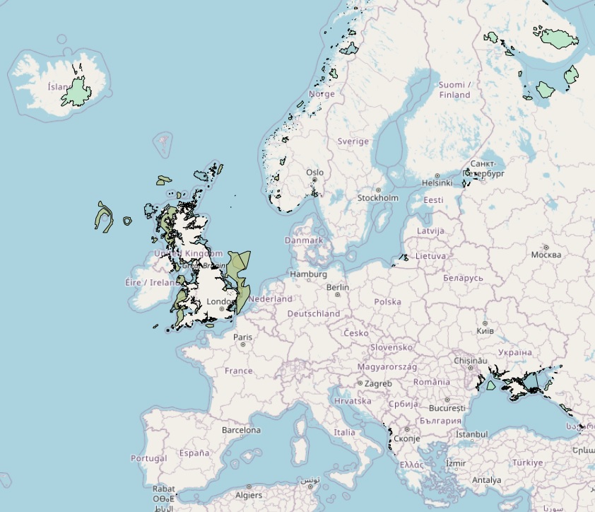
The dataset on Emerald Network sites was created in 2023 by Cogea for the European Marine Observation and Data Network. It is entirely based on spatial data from the European Environmental Agency (EEA), plus additional infos and selected EEA tabular data added as feature attributes. It is available for viewing and download on EMODnet web portal (Human Activities, https://emodnet.ec.europa.eu/en/human-activities). The Emerald Network is an ecological network made up of Areas of Special Conservation Interest designated under Recommendation No. 16 (1989) and Resolution No. 3 (1996) of the Standing Committee to the Bern Convention. The objective of the Emerald Network is the long-term survival of the species and habitats. The Network involves all the European Union member States (the European Union contributes to the Emerald Network with its Natura 2000 sites), some non-Community States and a number of African States. The dataset cover the following countries: Albania, Andorra, Armenia, Azerbaijan, Belarus, Bosnia and Herzegovina, Georgia, Iceland, Liechtenstein, Moldova, Montenegro, North Macedonia, Norway, Russian Federation (European part), Serbia, Switzerland, Ukraine and the United Kingdom. In the webmap the dataset has been filtered in order to show only marine and coastal sites. Where available each polygon has the following attributes: site code, site name, country code, country name, site type/description (A: SPA, Special Protection Areas - sites designated under the Birds Directive; B: SCIs and SACs, Sites of Community Importance and Special Areas of Conservation - sites designated under the Habitats Directive; C: where SPAs and SCIs/SACs boundaries are identical, sites are designated under both directives), site status (Proposed, Candidate or Adopted), compilation date, update date, area (ha), marine area percentage, marine/coastal location (1). For further information (e.g. biogeographic region, designation status, sites, habitats, impact, management, species and metadata) please visit the EEA's website hosting the Emerald tabular data (https://www.eea.europa.eu/data-and-maps/data/emerald-network-data-1/emerald-tabular-data). This version covers the reporting in 2021.
-
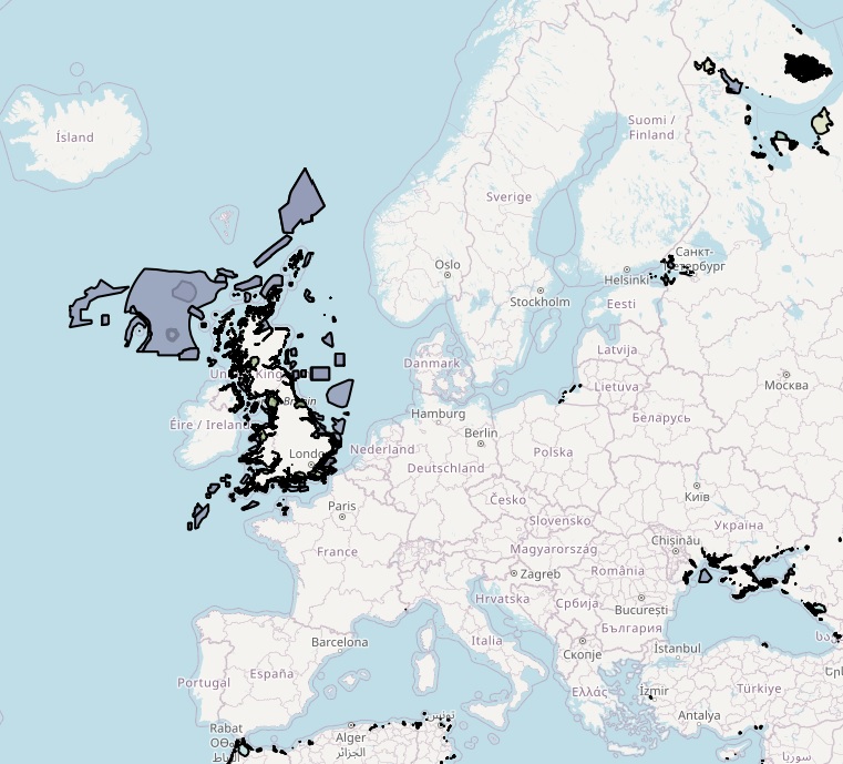
The dataset on coastal and marine protected areas in the European seas for those countries or territories that are not covered by the the EEA's Common Database on Designated Areas (CDDA) was created in 2022 by Cogea for the European Marine Observation and Data Network (EMODnet). This dataset is entirely based on GIS vector data from UNEP-WCMC and IUCN 2023, (Protected Planet: The World Database on Protected Areas, WDPA, [Online], September 2023, Cambridge, UK: UNEP-WCMC and IUCN, available at: www.protectedplanet.net), plus additional info and selected tabular data added as feature attributes, as well as the calculation of marine and coastal location of features. It is available for viewing and download on EMODnet web portal (Human Activities, https://emodnet.ec.europa.eu/en/human-activities). The WDPA is the most comprehensive global database of marine and terrestrial protected areas, it is a joint project between UN Environment Programme (UNEP) and the International Union for Conservation of Nature (IUCN), and it is managed by the UNEP World Conservation Monitoring Centre (UNEP-WCMC), in collaboration with governments, non-governmental organisations, academia and industry. In the webmap the dataset has been filtered in order to show only marine and coastal areas. Geographical coverage: Algeria, Antigua and Barbuda, Barbados, Belize, Colombia, Costa Rica, Cuba, Denmark (only the Faroe Islands), Dominica, Dominican Republic, Egypt, France (only Guadeloupe, Martinique, Saint Barthélemy, Saint Martin French part), Georgia, Grenada, Guatemala, Haiti, Honduras, Israel, Jamaica, Lebanon, Mexico, Monaco, Morocco, Netherlands (only Aruba, Curaçao, Bonaire, Sint Eustatius and Saba, Sint Maarten Dutch part) Nicaragua, Norway (only Svalbard and Jan Mayen), Palestine, Panama, Russian Federation, Saint Kitts and Nevis, Saint Lucia, Saint Vincent and the Grenadines, Trinidad and Tobago, Tunisia, Turkey, Ukraine, United Kingdom (including Anguilla, British Virgin Islands, Cayman Islands, Guernsey, Isle of Man, Jersey, Montserrat), United States (only Puerto Rico, the US Virgin Islands and the US Minor Outlying Islands in the Caribbean Sea), Venezuela. Where available each polygon has the following main attributes: country code, territory code, country name, territory name, WDPA ID, name (english and original), designation name (english and original) and type (International, National, Not Applicable, Regional), IUCN category and description (Ia: Strict Nature Reserve; Ib: Wilderness Area; II: National Park; III: Natural Monument or Feature; IV: Habitat/Species Management Area; V: Protected Landscape/ Seascape; VI: Protected area with sustainable use of natural resources; Not applicable; Not assigned; Not reported), marine location (1: predominantly marine; 2: entirely marine), area sqkm (reported, calculated), marine area sqkm (reported, calculated), status (Adopted, Designated, Established, Inscribed, Not Reported, Proposed), government type (Collaborative governance, Federal or national ministry or agency, For-profit organisations, Government-delegated management, Indigenous peoples, Individual landowners, Joint governance, Local communities, Non-profit organisations, Not Reported, Sub-national ministry or agency), ownership type (Communal, For-profit organisations, Individual landowners, Joint ownership, Multiple ownership, Non-profit organisations, Not Reported, State), management authorithy and plan info, marine/coastal location (1). For further information please visit the Protected Planet website. Compared with the previous release, this one includes the updated dataset 'WDPA_Sep2023_Public' published by the WDPA in September 2023 and it includes the marine and coastal protected areas in the Caribbean Sea.
-
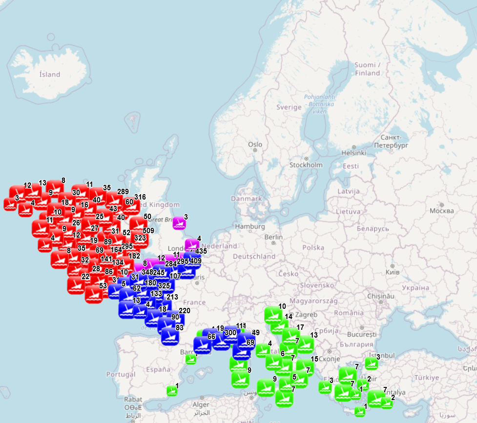
The dataset combines data collected from several sources: data collected and processed by the “Service hydrographique et océanographique de la marine” (SHOM) under the product “Wrecks and obstructions” for France (Hexagone and outermost regions and territories), The National Monument Service Wreck Viewer for Ireland, Historic England and the University of Oxford - The Oxford Roman Economy Project (Strauss, J. (2013). Shipwrecks Database. Version 1.0. Accessed (date): oxrep.classics.ox.ac.uk/databases/shipwrecks_database/) for archeological remains of ship wrecks in the Mediterranean. The different products were developed with different purposes and therefore provide information of different nature. The product developed by SHOM aims to identify objects emerging from the seabed and likely to hinder navigation, while the three other products focus on the historical value of the wrecks. The choice was made to keep as much information as possible. When possible fields from different sources have been merged (e.g. least depth available in SHOM data and the Oxford Roman Economy Project), but other fields correspond to a specific source. When available, information is provided on the nature of the objects (object description, ship characteristics, object type, artefacts, estimated tonnage), on the aging of the wrecks (sink year, dating, period), on the circumstances of the sinking (sink context, place of origine, place of destination), on the location (least depth, max depth, other depth information, object length, location precision, site area, coast distance), on the protection status (only for England) and on sources and additional information available (source information, references, website, website 2). The additional processing carried out by EMODnet consisted in translating the available information to English (through partly-automated translation), extracting the year of the sinking when available and calculating the distance to coast. Last update of the product by SHOM was made in November 2021, last update of the Historic England data was made in August 2021, update of the National Monument Service Wreck Viewer in Ireland was made I April 2018 and the Oxford Roman Economy Project was carried out in 2013.
-
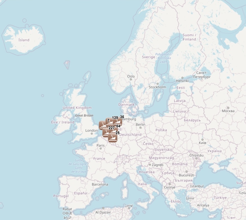
The dataset has been developped under the MACHU EU project, involving seven EU MS (BE, DE, NL, PL, PT, UK, SE). The MACHU GIS database provides information about wrecks, sites and objects underwater. MACHU is an applications on Underwater Cultural Heritage providing historic and archaeological information. MACHU is not intended to give exact positions of wrecks an site, in the aim of ensuring their protection.
-
This dataset contains the habitats map from the SCI (Site of Community Importance) ÔÇ£Volcanes de fango del Golfo de C├ídizÔÇØ. The Gulf of Cadiz is located in the eastern sector of the North Atlantic Ocean, to the southwest of the Iberian Peninsula. Mud Volcanoes are seafloor edifices, of a usually conical geometry, that result from the release of mud, hydrocarbon and fluids in gas-rich areas over pressured sediments. This study was supported by the INDEMARES-LIFE+ Project, EC contract INDEMARES-LIFE+ (07/NAT/E/000732): Inventory and Designation of the Natura 2000 network in marine areas of the Spanish State (www.indemares.es/en). This work was coordinated by the Spanish Institute of Oceanography (IEO, www.ieo.es) and the Biodiversity Foundation (www.fundacion-biodiversidad.es). The interpretation has been made possible thanks to direct and indirect samplings and geophysical data from campaigns INDEMARES_CHICA (CHICA0610, CHICA0211, CHICA1011 and CHICA0412). Habitats are classified according to EUNIS nomenclature and the List of Marine Habitats in Spain (LPRE, that itÔÇÖs classified hierarchically and was completed and published in March 2013).
-
This dataset contains the main habitats maps from the SCI (Site of Community Importance) ÔÇ£Banco de GaliciaÔÇØ. The Galician Bank is a deep underwater mountain located at the northwest of the Iberian Peninsula, 180 km from the Galician coast (in the north-east Atlantic Ocean). Its summit is located at a depth of between 650 and 1,500 metres. Its steep slopes descend from the summit to the abyssal plains located 4,000 meters below sea level. This study was supported by the INDEMARES-LIFE+ Project, EC contract INDEMARES-LIFE+ (07/NAT/E/000732): Inventory and Designation of the Natura 2000 network in marine areas of the Spanish State (www.indemares.es/en). This work was coordinated by the Spanish Institute of Oceanography (IEO, www.ieo.es) and the Biodiversity Foundation (www.fundacion-biodiversidad.es). The interpretation has been made possible thanks to direct and indirect samplings and geophysical data from campaigns "ECOMARG09", "INDEMARES_BANGAL0810", "INDEMARES_BANGAL0711" and "RADPROF0912". Habitats are classified according to EUNIS nomenclature and the List of Marine Habitats in Spain (LPRE, that itÔÇÖs classified hierarchically and was completed and published in March 2013).
-
This dataset contains the habitats map from the SCI (Site of Community Importance) ÔÇ£Sistema de ca├▒ones submarinos de Avil├®sÔÇØ (Avil├®s Canyon System). The Avil├®s Canyon system is located in the eastern sector of the North Atlantic Ocean, on the continental margin to the north of the Iberian Peninsula. It is structurally a highly complex area, where the continental shelf in the Bay of Biscay is deeply affected by the action of tectonic compression, containing important geomorphological elements; these include: three great submarine canyons, a marginal platform and a tall structural rocky mass. This study was supported by the INDEMARES-LIFE+ Project, EC contract INDEMARES-LIFE+ (07/NAT/E/000732): Inventory and Designation of the Natura 2000 network in marine areas of the Spanish State (www.indemares.es/en). This work was coordinated by the Spanish Institute of Oceanography (IEO, www.ieo.es) and the Biodiversity Foundation (www.fundacion-biodiversidad.es). The interpretation has been made possible thanks to direct and indirect samplings and geophysical data from campaigns INDEMARES (AVILES_0710, AVILES_0410, AVILES_0412-0912). Habitats are classified according to EUNIS nomenclature and the List of Marine Habitats in Spain (LPRE, that itÔÇÖs classified hierarchically and was completed and published in March 2013).